 |
 |
 |
Loading...
| Search Result for "610" | ||||
| Lot | Description | Status | ||
20279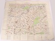 Click for more photos | Maps: WWI GB Ordnance Dept Survey Maps. France sheet 62D First Edition. Inc Villers-Brettoneux & Hamel. Pub March 1918, scale 1:40,000. Sheet 66D, NW Edition April 17. Showing enemy trench, British front line trenches found cut up by artillery fire, mine craters etc. Scale 1:20,000. Belgium Valanciennes 2nd ed. War Office 1916. Inc Cambrai. Scale 1:100,000 & March 1912 showing German & Luxembourg borders. Scale 1:100,000. All multi-colour printed on linen lacked paper, overall size 850mmx610mm. The last with some flts, others some age stains, minor faults but generally GC. The first map a must have for any WWI collector. (4 maps) | SOLD at A$100 | ||
|---|---|---|---|---|
20546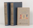 Click for more photos | Canada. 1873-93 'The North West Mounted Police' 2 vols, by John Peter Turner, 1950. Rebound H/C, vols 1 & 2, text with photographs & illustrations & fold-out map. Vol I: 686 pgs, Vol II: 610 pgs. Together with a US Civil War Novel, 1903.' The Southerners' by Cyrus Townsend Brady. VGC. Early history of the 'Canadian Mounties'. Scarce. (3) | AVAILABLE at A$50 | ||